Software For Mapping & GIS

Broad range of field and office software solutions designed for Mapping & GIS applications.

Trimble GIS software products are ideal for fast and efficient field GIS data collection and maintenance. Whether you need to populate a GIS for the first time, update your existing GIS database, or simply view and query GIS data in the field, Trimble’s software tools ensure you maximize productivity and data quality.

Trimble/Applanix leading mapping software tools enable GNSS/inertial post processing for georeferencing data collected from the field as well as data collected from cameras, LIDARs, multi-beam sonars and other sensors on mobile platforms.

Current Products include the POSPac MMS, TerraSync, TerraFlex, Pathfinder and Trimble Positions software.


Datasheet for Trimble GIS  Software Product Comparison


Quotation Request

GPS Pathfinder® Office software

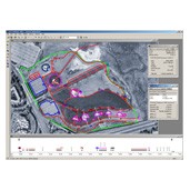
Trimble® GPS Pathfinder® Office software is a powerful and easy-to-use software package of GNSS post processing tools. Incorporating Trimble® DeltaPhase™ differential correction technology the software is designed to develop GIS information that is consistent, reliable, and accurate from GNSS data collected in the field.

  • Differential corrections to improve the quality of GNSS data collected in the field
  • H-Star data processing for high accuracy and support for GLONASS post processing
  • Data import and export in a variety of GIS and CAD formats
  • Sophisticated data dictionary editor to ensure consistency between the field and the office
  • Quality control of GNSS data before exporting to GIS

TerraFlex™ software

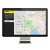
Trimble® TerraFlex™ software is a flexible and configurable cloud-based solution for field data collection and real-time updating of geospatial information. This robust application provides a full collection of customizable digital forms so you can collect attribute rich and accurate geo-located GIS and asset information all in one workflow.

Fast and easy to use with one platform for all devices, delivering standardized, consistent data from the field each and every time. Available in two editions—Basic and Advanced— TerraFlex software makes sure your data is up-to-date and reliable.

TerraFlex is part of Trimble InSphere™, a cloud based platform of software, data and services to streamline workflows for geospatial enterprises.

  • Fast, efficient data collection across a fleet of mixed devices
  • Keep your project data organized in the field and office
  • Import and update existing data for up-to-the-minute information
  • Work anywhere with streamlined data management workflows

TerraSync™ software

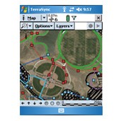
Trimble® TerraSync™ software is designed for fast and efficient field GIS data collection and maintenance. Integrating all the ways you collect data—with a GNSS handheld computer, laser rangefinder, or centimeter-grade equipment—it’s a powerful system for the collection of high quality feature and position data for GIS update and maintenance.

You can choose the edition that suits your needs:

  • Standard edition: For data collection projects that do not require the update or maintenance of data.
  • Professional edition: Provides all the functionality required for data collection and maintenance projects.
  • Centimeter edition: All the functionality of the Professional edition with the ability to connect with centimeter-grade receivers.

Key features:

  • Software designed for efficient field GIS data collection and maintenance
  • QuickPoint data collection mode for easy productive one-click data capture
  • Optimized for Trimble handhelds with integrated digital cameras
  • Support for centimeter-grade RTK receivers
  • Conditional attributes for dynamically adapting data capture forms
  • Customizable user interface simplifies field operation
  • Smart data maintenance
  • Seamless GNSS control in the field for high quality position data

Trimble Positions

Trimble Positions is the smart way to ensure your GIS is populated with field data you can trust.
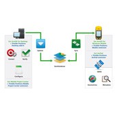
Whether you are working with Esri ArcGIS for Windows Mobile®, Windows® Professional, Esri ArcPad, a custom application based on the above, or using Trimble® TerraSync™ or Trimble TerraFlex™ software, the Trimble® Positions™ software suite provides a complete streamlined workflow to manage your GNSS data collection for optimal accuracy and integrity.

  • Rusted data quality
  • Complete your work with total confidence