Field software solutions designed for Mapping & GIS applications helping to make your job quicker and easier.

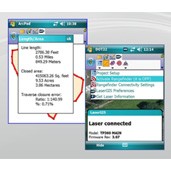
Make your laser work seamlessly within your GIS software with the first robust software extension that significantly enhances ArcPad®’s current laser offset functionality.
Key Features:
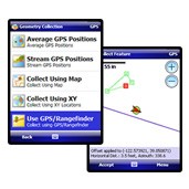
ESRI has recognized the value of mobile GIS by providing useful applications that give access to up-to-date, real-time GIS information while in the field. To increase your efficiency even more, these mobile applications allow for the TruPulse laser rangefinder to interface its distance, inclination and azimuth data into a current GPS location and create a corresponding vertex for target geometry.
Key Features of ArcGIS for Mobile:
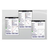
Perfect for a non-surveyor faced with a surveying task, an easy-to-use field data collection solution that will have you mapping like an expert in a matter of minutes.
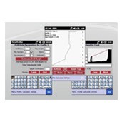
Laser Technology Face Profiler software calculates bench heights, minimum and optimum burdens, drill hole angles and offsets, hole depths and more. Take the guesswork out of blast design and start significantly reducing production delays. Accurately measures profiles to help minimize the risk of any dangerous fly rock and vibration incidents.
Runs on a touch-screen activated, rugged data collector that provides plenty of safe storage for your profile data. Print MSHA-approved profile reports right in the field with an optional Bluetooth® enabled printer.
Face Profiler combined with a professional TruPulse or Impulse laser range finder creates a complete profiling system designed to help maximize safety, manage inventory, and control the costs associated with blast design – for less money than any other laser profiling package on the market. (See laser packaging tab).
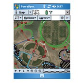
Trimble® TerraSync™ software is designed for fast and efficient field GIS data collection and maintenance. Integrating all the ways you collect data—with a GNSS handheld computer, laser rangefinder, or centimeter-grade equipment—it’s a powerful system for the collection of high quality feature and position data for GIS update and maintenance.
You can choose the edition that suits your needs:
Key features: