GNSS Positioning & Heading Systems

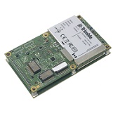
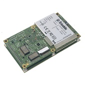
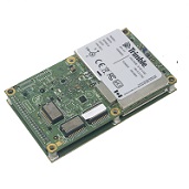
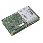
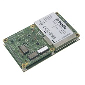
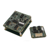
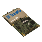
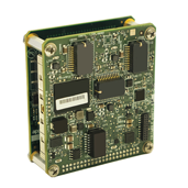
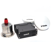
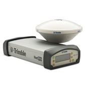
Quality GNSS Positioning and Heading Systems including GNSS Receiver modules/Communication Boards, GNSS Receiver Enclosures, Inertial OEM Positioning & Orientation Systems and GNSS Antennas.

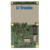
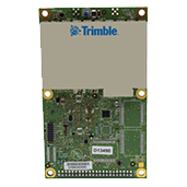
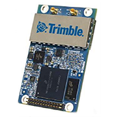
GNSS Boards/ GNSS +Communication Boards

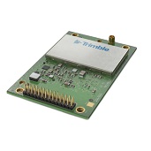
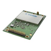
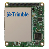
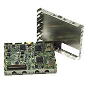
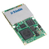
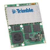
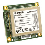
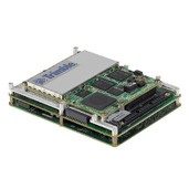
The latest centimeter-level positioning technology for system integrators. Trimble GPS/GNSS receivers are designed to allow easy incorporation into specialized or custom hardware solutions. Trimble GPS/GNSS receiver modules harness the widest range of GPS L1/L2/L5 and GLONASS L1/L2 signals in easy-to-integrate modules that provide fast Real-Time Kinematic (RTK) initialization with proven low-elevation tracking. Decimeter positioning with OmniSTAR XP/HP support is also available. GNSS + Communication boards include also Bluetooth & Wi-Fi or internal UHF modem. Trimble’s quality GPS/GNSS OEM receiver modules currently include the BD910, BD920, BD930, BD940, BD970, BD982, BD990, BD992, BD935 INS, BD940 INS, MB-One, MB-Two, BD920-W3G and the BD930-UHF.

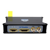
GNSS Sensors Enclosures

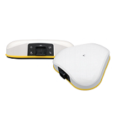
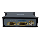
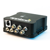
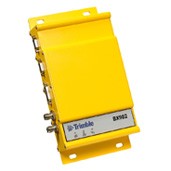
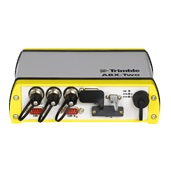
Trimble® GNSS receivers enclosures are multi-channel, multi-frequency rugged GNSS receivers allowing OEMs and System Integrators to rapidly integrate centimeter level positioning and precise heading into their application by using a dual antenna connection or by using an INS sensor. Trimble/Applanix line of GNSS OEM Sensors Enclosures include the Trimble BX940, Trimble BX992, Trimble BX982, Trimble BX935-INS, Trimble ABX-Two and Applanix POS AVX 210.

Inertial OEM Positioning & Orientation Systems

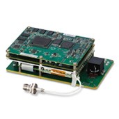
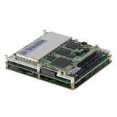
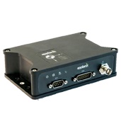
The Trimble – Applanix AP series include embedded GNSS-Inertial OEM boards plus Inertial Measurement Units (IMU) for continuous mobile positioning in poor signal environments and high-accuracy direct geo referencing of imaging sensors. Product line includes the Trimble AP10, AP15, AP20, AP40, AP50, AP60 and the Applanix APX-15UAV.

GNSS Antennas

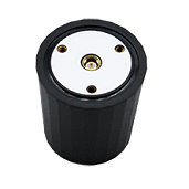
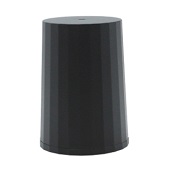
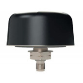
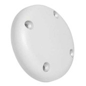
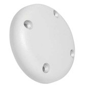
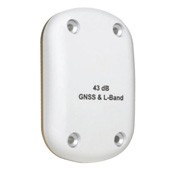
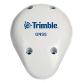
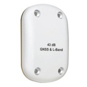
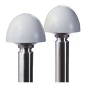
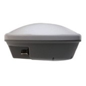
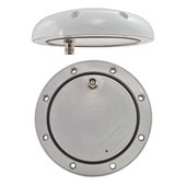
All Trimble Multi GNSS antennas conform to strict standards of consistency and performance to deliver the best possible tracking to support centimeter level accuracy on aerial, land and marine applications. Unique antenna designs provide the flexibility to reach a wide range of operational goals. The broad product offering include the AV28, AV33, AV34, AV37, AV59, LV59, AG25, GA810, the Zephyr antennas series, the Bulkhead and the bullet GG antennas and more.

For more information please review our products and solutions below or go to:

GNSS Boards

GNSS +Communication Boards

GNSS Sensors Enclosures

Inertial OEM Positioning & Orientation Systems

GNSS Antennas


Quotation Request

applanix-logo-2

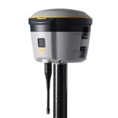
Trimble R580 GNSS STSTEM

Trimble R580 GNSS receiver is a compact, cable-free design with an integrated GNSS antenna, military-grade rugged design, IP65 rating.


The R580 with the Trimble Maxwell™ 7 technology anti‑spoofing capabilities includes the Trimble® ProPoint® GNSS positioning engine for improved accuracy and productivity in challenging GNSS conditions is a dependable integrated receiver to meet your everyday high accuracy needs.

Key Features:

  • Trimble Maxwell™ 7 technology anti‑spoofing capabilities
  • Trimble® ProPoint® GNSS positioning
  • Trimble IonoGuard™ technology
  • Trimble CenterPoint® RTX corrections via satellite or internet
  • Supports Trimble xFill® correction outage technology
  • Receive-only 450 MHz UHF radio
  • Compact, cable-free design with integrated GNSS antenna
  • Centimeter level position accuracy
  • Rechargeable, removable Lithium-ion battery in internal battery compartment

Trimble BD9250

The BD9250 is a dual-frequency L1/L2 or L5 field-switchable GNSS receiver with integrated MSS-Band to support Trimble RTX service.


Key Features:

  • Trimble Maxwell 7 Technology
  • 336 Channels for multi-constellation GNSS support
  • Trimble RTX Support
  • L1 + L2 or L5 (Field selectable)
  • Compact, lightweight design with industry standard pinouts
  • Centimeter-level position accuracy
  • Advanced RF Spectrum Monitoring
  • Anti-spoofing protection
  • Trimble ProPoint GNSS Positioning Engine

Trimble BD9250S

The BD9250s is a dual-frequency L1/L2 or L5 field-switchable GNSS receiver with integrated S-Band frequency to support the Indian Regional Navigation Satellite System, NavIC.

Key Features:

  • Trimble MaxwellTM 7 Technology
  • 3 Trimble RTX
  • 336 Channels for multi-constellation GNSS support
  • L1 + L2 or L5 (Field selectable)
  • Compact, lightweight design with industry standard pinouts
  • Centimeter-level position accuracy
  • Advanced RF Spectrum Monitoring
  • S-Band
  • Anti-spoofing protection
  • Trimble ProPoint GNSS Positioning Engine

AX940i

The new Trimble AX940i is a triple-frequency smart antenna with integrated inertial navigation system. Taking advantage of Trimble’s expertise in both GNSS and Inertial technology the AX940i has been designed for applications requiring continuous centimeter accuracy in a compact package. By integrating inertial sensors on the same module, robust high-accuracy positions are produced in all environments. The receiver is also ideal for use as a GNSS DGPS/RTK base station.

Key Featurs:

  • Trimble Maxwell™ 7 Technology
  • Trimble ProPoint™ positioning engine
  • Onboard high accuracy inertial sensor
  • package integrated with GNSS for precise position and orientation
  • 336 Channels for multi-constellation
  • GNSS support
  • Trimble RTX and OmniSTAR Support
  • Rugged IP67 Smart Antenna
  • Compact design for mobile applications
  • Flexible RS232, USB, CAN and Ethernet interfacing
  • Centimeter-level position accuracy
  • Advanced RF Spectrum Monitoring
  • Integrated WiFi, Bluetooth

AX940

The Trimble AX940 supports both triplefrequency for the GPS and GLONASS constellations plus dual-frequency from BeiDouand Galileo. As the number of satellites in the constellations grows the AX940 is ready to take advantage of the additional signals.

Key Features:

  • Trimble Maxwell™ 7 Technology
  • Trimble ProPoint™ positioning engine
  • 336 Channels for multi-constellation GNSS support
  • Trimble RTX and OmniSTAR Support
  • Rugged IP67 Smart Antenna
  • Compact design for mobile applications
  • Flexible RS232, USB and Ethernet interfacing
  • Centimeter-level position accuracy
  • Advanced RF Spectrum Monitoring

BD992-INS

The BD992-INS is a dual-antenna receiver with an integrated inertial navigation system. It is a robust navigation system that supports position and orientation at high update rates.

Key Features:

  • Trimble Maxwell 7 Technology
  • Onboard high accuracy inertial sensor package integrated with GNSS for precise position and orientation
  • 336 Channels for multi-constellation GNSS support
  • OmniSTAR/RTX Support
  • Compact design for mobile applications
  • Flexible RS232, USB and Ethernet interfacing
  • Centimeter level position accuracy
  • Advanced RF Spectrum Monitoring

BX992

The BX992 enclosure is a dual-antenna receiver with integrated inertial navigation system powered by the BD992-INS. The unit structure is an environmentally sealed enclosure built to withstand harsh environments.

Key Features:

  • Trimble Maxwell 7 Technology
  • Onboard high accuracy inertial sensor package integrated with GNSS for precise position and orientation
  • 336 Channels for multi-constellation GNSS support
  • OmniSTAR/RTX Support
  • Compact design for mobile applications
  • Flexible RS232, USB and Ethernet interfacing
  • Centimeter level position accuracy

Advanced RF Spectrum Monitoring

BD992

The BD992 is a dual-antenna receiver that delivers centimeter accurate positions and precise heading. Heading derived from dual-antenna GNSS measurements helps overcome issues such as difficulty determining where the antenna is positioned relative to the vehicle and object of interest.

Key Features:

  • Trimble Maxwell 7 Technology
  • Dual-antenna inputs for precise heading calculation
  • 336 Channels for multi-constellation GNSS support
  • OmniSTAR/RTX Support
  • Compact design for mobile applications
  • Flexible RS232, USB and Ethernet interfacing
  • Centimeter level position accuracy
  • Advanced RF Spectrum Monitoring
mb-two

MB-Two

Versatile, powerful, compact and smart. The Trimble MB-Two provides faster Dual Frequency based Heading acquisition and an improved positioning engine with additional GNSS signals. In addition, two MB-Two modules may be used for Precise Platform Position (P3) using data from three antennas for full GNSS attitude.

Key Features:

    • Precise Heading + Pitch/Roll
    • Improved Dual Frequency Heading
    • Dual Core Engine with Z-Blade Technology
    • Precise Platform Positioning (P3)
    • Web User-Interface
    • Supports Trimble® CenterPoint® RTX for up to 4 cm accuracy
    • Superior Connectivity
    • Ethernet, USB 2.0, Serial Ports (LVTTL)
    • Small Form Factor
    • Low Power

BD940-INS

The BD940-INS integrates the latest in precision inertial sensors on the same module where robust high accuracy positions are produced in all environments. As the number of satellites in the constellations grows, the BD940-INS is ready to take advantage of the additional signals.

Key Features:

  • Trimble Maxwell 7 Technology
  • Onboard high accuracy inertial sensor package integrated with GNSS for precise position and orientation
  • 336 Channels for multi-constellation GNSS support
  • OmniSTAR/RTX Support
  • EMI shielded module
  • Compact design for mobile applications
  • Flexible RS232, USB and Ethernet interfacing
  • Centimeter level position accuracy
  • Advanced RF Spectrum Monitoring

BX940

The BX940 enclosure is an integrated GNSS-Inertial engine delivering high accuracy GNSS, DGNSS positions in the most challenging environments powered by the BD940-INS. The unit is a robust navigation solution that has an environmentally sealed enclosure.

Key Features:

  • Trimble Maxwell 7 Technology
  • Onboard high accuracy inertial sensor package integrated with GNSS for precise position and orientation
  • 336 Channels for multi-constellation GNSS support
  • OmniSTAR/RTX Support
  • EMI shielded module
  • Compact design for mobile applications
  • Flexible RS232, USB and Ethernet interfacing
  • Centimeter level position accuracy
  • Advanced RF Spectrum Monitoring

BD940

The BD940 is a triple frequency receiver that delivers the quickest and most reliable RTK and RTX initializations for centimeter positioning. The BD940 reduces radiated emissions which speeds compliance certification and time to market. It provides assurance of long-term future-proofing and trouble-free operation.

Key Features:

  • Trimble Maxwell 7 Technology
  • 336 Channels for multi-constellation GNSS support
  • OmniSTAR/RTX Support
  • EMI shielded module
  • Compact design for mobile applications
  • Flexible RS232, USB and Ethernet interfacing
  • Centimeter level position accuracy
  • Advanced RF Spectrum Monitoring

BD990

The BD990 is a triple frequency receiver for all GNSS constellations. The BD990, along with the rest of the BD product family, redefines high-performance positioning and comes with easy to use software which simplifies integration and reduces development time.

Key Features:

  • Trimble Maxwell 7 Technology
  • 336 Channels for multi-constellation GNSS support
  • OmniSTAR/RTX Support
  • Compact design for mobile applications
  • Flexible RS232, USB and Ethernet interfacing
  • Centimeter level position accuracy
  • Advanced RF Spectrum Monitoring

APX RTX

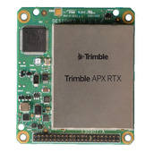
The APX RTX portfolio offers both real-time and post-mission direct georeferencing. This capability allows for centimeter-level accuracy without the need for base stations, making it compatible with various sensors, including cameras, lidar and hyperspectral mapping devices.


The APX RTX is a compact survey-grade GNSS inertial unit that delivers real-time positioning and highly accurate roll, pitch and heading measurements.

Key Features:

  • Supports Trimble ProPoint GNSS technology to offer consistent performance in various environments
  • Supports Trimble CenterPoint RTX Complete subscription combining real-time functionality with post-processing capabilities in POSPac UAV
  • Turns your UAV into a professional mapping solution
  • Ultra-fast image georeferencing for faster map production and delivery without the need for base stations
  • Reduced number of ground control points, saving time and money
  • Consistent, reliable, highly accurate results
  • Increased collection area per flight for greater productivity
  • Redundant navigation solution to autopilot for enhanced safety

AP+ 18 Air

The Trimble AP+ 18 Air GNSS-inertial system is comprised of next-generation compact, low-power hardware, featuring dual embedded survey-grade GNSS chipsets, an onboard inertial measurement unit (IMU), and the all-new Applanix IN-Fusion+ GNSS-aided inertial firmware.


The AP+ Air models determine the accuracy of the product. While positioning accuracy remains the same across all products, the inertial sensors used dictate the orientation performance. The entry-level product in terms of accuracy is the AP+ 18. It is available in two forms: AP+ 18 using the onboard IMU, and the AP+18 EI using the onboard and external IMU. The models AP+ 30, AP+ 50, and AP+ 60 all use the same onboard IMU but different external IMU’s to achieve higher orientation accuracy. The AP+ Air product is highly configurable making it ideal for payload manufacturers.

Key Features:

  • Powerful low powered Single platform that can be used on manned platforms, yet small enough for use on unmanned aerial vehicles (UAVS) which saves costs
  • Has the form of Trimble AP GNSS-Inertial Board Set plus inertial Measurement Unit (IMU)
  • High-performance Direct Geo-referencing
  • Instant alignment through dual GNSS antenna heading
  • Survey-grade multi-frequency GNSS receiver and MEMS inertial components
  • Next generation Applanix IN-Fusion+ GNSS-Inertial Aided firmware
  • Onboard Internal IMU with optional Dual IMU support for simple gimbal mount
  • Supports RTK real-time position for precision landing applications
  • Supports all common RTK corrections such as CMR, CMR+, RTCM
  • Reduced SwaP (Size, Weight, and Power) 54% smaller footprint, 64% lighter,75% less power
  • Completely configurable, from entry-level UAV applications, all the way up to high accuracy solutions for high altitude LiDAR mapping
  • Fully supported by the Applanix POSPac MMS post-processing software
  • Supports Trimble Realtime an post-processing CenterPoint® RTX Corrections
  • No export permit required

AP+ 18 EI Air

The Trimble AP+ 18 EI Air GNSS-inertial system is comprised of next-generation compact, low-power hardware, featuring dual embedded survey-grade GNSS chipsets, an onboard inertial measurement unit (IMU) and an external IMU-69, and the all-new Applanix IN-Fusion+ GNSS-aided inertial firmware.


The AP+ Air models determine the accuracy of the product. While positioning accuracy remains the same across all products, the inertial sensors used dictate the orientation performance. The entry-level product in terms of accuracy is the AP+ 18. It is available in two forms: AP+ 18 using the onboard IMU, and the AP+18 EI using the onboard and external IMU. The models AP+ 30, AP+ 50, and AP+ 60 all use the same onboard IMU but different external IMU’s to achieve higher orientation accuracy. The AP+ Air product is highly configurable making it ideal for payload manufacturers.

Key Features:

  • Powerful low powered Single platform that can be used on manned platforms, yet small enough for use on unmanned aerial vehicles (UAVS) which saves costs
  • Has the form of Trimble AP GNSS-Inertial Board Set plus inertial Measurement Unit (IMU)
  • High-performance Direct Geo-referencing
  • Instant alignment through dual GNSS antenna heading
  • Survey-grade multi-frequency GNSS receiver and MEMS inertial components
  • Next generation Applanix IN-Fusion+ GNSS-Inertial Aided firmware
  • Dual IMU (onboard and external) for simple gimbal mount
  • Supports RTK real-time position for precision landing applications
  • Supports all common RTK corrections such as CMR, CMR+, RTCM
  • Reduced SwaP (Size, Weight, and Power) 54% smaller footprint, 64% lighter,75% less power
  • Completely configurable, from entry-level UAV applications, all the way up to high accuracy solutions for high altitude LiDAR mapping
  • Fully supported by the Applanix POSPac MMS post-processing software
  • Supports Trimble Realtime an post-processing CenterPoint® RTX Corrections
  • No export permit required

AP+ 30 Air

The Trimble AP+ 30 Air GNSS-inertial system is comprised of next-generation compact, low-power hardware, featuring dual embedded survey-grade GNSS chipsets, an onboard inertial measurement unit (IMU) and an external IMU-82, and the all-new Applanix IN-Fusion+ GNSS-aided inertial firmware.


The AP+ Air models determine the accuracy of the product. While positioning accuracy remains the same across all products, the inertial sensors used dictate the orientation performance. The entry-level product in terms of accuracy is the AP+ 18. It is available in two forms: AP+ 18 using the onboard IMU, and the AP+18 EI using the onboard and external IMU. The models AP+ 30, AP+ 50, and AP+ 60 all use the same onboard IMU but different external IMU’s to achieve higher orientation accuracy. The AP+ Air product is highly configurable making it ideal for payload manufacturers.

Key Features:

  • Powerful low powered Single platform that can be used on manned platforms, yet small enough for use on unmanned aerial vehicles (UAVS) which saves costs
  • Has the form of Trimble AP GNSS-Inertial Board Set plus inertial Measurement Unit (IMU)
  • High-performance Direct Geo-referencing
  • Instant alignment through dual GNSS antenna heading
  • Survey-grade multi-frequency GNSS receiver and MEMS inertial components
  • Next generation Applanix IN-Fusion+ GNSS-Inertial Aided firmware
  • Dual IMU (onboard and external) for simple gimbal mount
  • Supports RTK real-time position for precision landing applications
  • Supports all common RTK corrections such as CMR, CMR+, RTCM
  • Reduced SwaP (Size, Weight, and Power) 54% smaller footprint, 64% lighter,75% less power
  • Completely configurable, from entry-level UAV applications, all the way up to high accuracy solutions for high altitude LiDAR mapping
  • Fully supported by the Applanix POSPac MMS post-processing software
  • Supports Trimble Realtime an post-processing CenterPoint® RTX Corrections
  • No export permit required

AP+ 50 Air

The Trimble AP+ 50 Air GNSS-inertial system is comprised of next-generation compact, low-power hardware, featuring dual embedded survey-grade GNSS chipsets, an onboard inertial measurement unit (IMU) and an external IMU-91, and the all-new Applanix IN-Fusion+ GNSS-aided inertial firmware.


The AP+ Air models determine the accuracy of the product. While positioning accuracy remains the same across all products, the inertial sensors used dictate the orientation performance. The entry-level product in terms of accuracy is the AP+ 18. It is available in two forms: AP+ 18 using the onboard IMU, and the AP+18 EI using the onboard and external IMU. The models AP+ 30, AP+ 50, and AP+ 60 all use the same onboard IMU but different external IMU’s to achieve higher orientation accuracy. The AP+ Air product is highly configurable making it ideal for payload manufacturers.

Key Features:

  • Powerful low powered Single platform that can be used on manned platforms, yet small enough for use on unmanned aerial vehicles (UAVS) which saves costs
    • Has the form of Trimble AP GNSS-Inertial Board Set plus inertial Measurement Unit (IMU)
    • High-performance Direct Geo-referencing
    • Instant alignment through dual GNSS antenna heading
    • Survey-grade multi-frequency GNSS receiver and MEMS inertial components
    • Next generation Applanix IN-Fusion+ GNSS-Inertial Aided firmware
    • Dual IMU (onboard and external) for simple gimbal mount
    • Supports RTK real-time position for precision landing applications
    • Supports all common RTK corrections such as CMR, CMR+, RTCM
    • Reduced SwaP (Size, Weight, and Power) 54% smaller footprint, 64% lighter,75% less power
    • Completely configurable, from entry-level UAV applications, all the way up to high accuracy solutions for high altitude LiDAR mapping
    • Fully supported by the Applanix POSPac MMS post-processing software
    • Supports Trimble Realtime an post-processing CenterPoint® RTX Corrections
    • No export permit required

AP+ 60 Air

The Trimble AP+ 60 Air GNSS-inertial system is comprised of next-generation compact, low-power hardware, featuring dual embedded survey-grade GNSS chipsets, an onboard inertial measurement unit (IMU) and an external IMU-57, and the all-new Applanix IN-Fusion+ GNSS-aided inertial firmware.


The AP+ Air models determine the accuracy of the product. While positioning accuracy remains the same across all products, the inertial sensors used dictate the orientation performance. The entry-level product in terms of accuracy is the AP+ 18. It is available in two forms: AP+ 18 using the onboard IMU, and the AP+18 EI using the onboard and external IMU. The models AP+ 30, AP+ 50, and AP+ 60 all use the same onboard IMU but different external IMU’s to achieve higher orientation accuracy. The AP+ Air product is highly configurable making it ideal for payload manufacturers.

Key Features:

  • Powerful low powered Single platform that can be used on manned platforms, yet small enough for use on unmanned aerial vehicles (UAVS) which saves costs
  • Has the form of Trimble AP GNSS-Inertial Board Set plus inertial Measurement Unit (IMU) High-performance Direct Geo-referencing
  • Instant alignment through dual GNSS antenna heading
  • Survey-grade multi-frequency GNSS receiver and MEMS inertial components
  • Next generation Applanix IN-Fusion+ GNSS-Inertial Aided firmware
  • Dual IMU (onboard and external) for simple gimbal mount
  • Supports RTK real-time position for precision landing applications
  • Supports all common RTK corrections such as CMR, CMR+, RTCM
  • Reduced SwaP (Size, Weight, and Power) 54% smaller footprint, 64% lighter,75% less power
  • Completely configurable, from entry-level UAV applications, all the way up to high accuracy solutions for high altitude LiDAR mapping
  • Fully supported by the Applanix POSPac MMS post-processing software
  • Supports Trimble Realtime an post-processing CenterPoint® RTX Corrections
  • No export permit required

APX-15 UAV

The Applanix APX-15 UAV is a GNSS-Inertial OEM solution designed to reduce the cost and improve the efficiency of mapping from small Unmanned Aerial Vehicles.


Key Features:

  • High-performance Direct Georeferencing solution for improved efficiency and accuracy of mapping from small Unmanned Aerial Vehicles
  • Reduces/eliminates GCP’s
  • Reduces Side lap
  • Accurate LIDAR georeferencing
  • Compact Single-Board OEM module complete with survey-grade multifrequency GNSS Receiver and MEMS inertial components
  • Applanix IN-FusionTM GNSS-Inertial and SmartCalTM compensation technology for superior Position and orientation performance
  • POSPac UAV Differential GNSS Inertial post-processing Software for highest accuracy
  • RTK real-time position for precision landing applications
  • High-accuracy real-time orientation
Trimble APX-15 EI UAV

APX-15 EI UAV

The Trimble APX-15 EI UAV is a GNSS-Inertial OEM solution designed to reduce the cost and improve the efficiency of mapping from small Unmanned Aerial Vehicles (UAVs). Comprised of small, low power, precision GNSS and inertial hardware components and POSPac UAV post-mission Differential GNSS-Inertial office software, the APX15 EI UAV eliminates the need to survey extensive Ground Control Points (GCP’s), and reduces the amount of sidelap required to be flown per flight. The innovative APX-15 EI UAV features a precision, survey grade GNSS receiver and dual inertial measurement units with identical performance; one embedded onto the GNSS-inertial board and one as an external unit connected remotely. With this feature the APX-15 EI can compute two sets of orientation for direct georeferencing of two separate sensor payloads, or to provide automatic support for gimballed platforms without requiring an external interface.

Key Features:

    • High-performance Direct Geo-referencing solution for improved efficiency and accuracy of mapping from small Unmanned Aerial Vehicles Reduce/eliminate GCPs
    • Accurate LIDAR/Camera geo-referencing
    • Seamless workflow with gimballed platforms
    • Compact OEM module complete with survey-grade multi-frequency GNSS receiver and embedded and external IMU’s
    • Applanix IN-FusionTM GNSS-Inertial and SmartCalTM compensation technology for superior position and orientation performance
    • POSPac UAV Differential GNSS Inertial post-processing software for highest accuracy Geo-referencing
    • RTK real-time position for precision landing and real-time mapping applications
    • Supports all common RTK corrections such as CMR, CMR+, RTCM
APX-18 UAV

APX-18 UAV

The Trimble APX-18 UAV is an OEM GNSS-Inertial solution with dual GNSS antenna input, designed to georeference LIDAR and other imaging data when collected from Unmanned Aerial Vehicles (UAV) at low speeds or when hovering. Comprised of a small single OEM board containing a precision GNSS receiver with two antenna heading and inertial sensor components plus POSPac UAV Differential GNSS-Inertial office software, the Trimble APX-18 UAV produces a highly accurate position and orientation solution for directly georeferencing LIDAR point clouds and imagery.

Key Features:  

    • High-performance Direct Geo-referencing solution for improved efficiency and accuracy of mapping from small Unmanned Aerial Vehicles Reduce/eliminate GCP’s
    • Accurate LIDAR geo-referencing
    • Instant alignment through dual GNSS antenna heading
    • Compact single-board OEM module complete with survey-grade multi-frequency GNSS receiver and MEMS inertial components
    • Applanix IN-FusionTM GNSS-Inertial and SmartCalTM compensation technology for superior position and orientation performance
    • POSPac UAV Differential GNSS Inertial post-processing software for highest accuracy
    • RTK real-time position for precision landing applications
    • Supports all common RTK corrections such as CMR, CMR+, RTCM


Trimble APX-20 UAV

APX-20 UAV

The Trimble APX-20 UAV is a GNSS-Inertial OEM solution designed to reduce the cost and improve the efficiency of mapping from small Unmanned Aerial Vehicles (UAVs). Comprised of small, low power, precision GNSS and inertial hardware components and POSPac UAV post-mission Differential GNSS-Inertial office software, the APX-20 UAV eliminates the need to survey extensive Ground Control Points (GCP’s), and reduces the amount of sidelap required to be flown per flight. The innovative APX-20 UAV features a precision, survey grade GNSS receiver and dual inertial measurement units; one embedded onto the GNSS-inertial board and one as an external unit mounted on the sensor to be georeferenced. With this feature the APX-20 UAV automatically supports integration on gimballed platforms without requiring an external interface to an autopilot or the mount itself.

Key Features:

High-performance Direct Geo-referencing solution for improved efficiency and accuracy of mapping from small Unmanned Aerial Vehicles Reduce/eliminate GCP’s

    • Accurate LIDAR/Camera geo-referencing
    • Seamless workflow with gimballed platforms
    • Compact OEM module complete with survey-grade multi-frequency GNSS receiver and embedded and external IMU’s
    • Applanix IN-FusionTM GNSS-Inertial and SmartCalTM compensation technology for superior position and orientation performance
    • POSPac UAV Differential GNSS Inertial post-processing software for highest accuracy Geo-referencing
    • RTK real-time position for precision landing and real-time mapping applications
    • Supports all common RTK corrections such as CMR, CMR+, RTCM
Trimble POS LV 125

POS LV 125

The Applanix POS LV 125 (Position and Orientation Solution for Land Vehicles) is a compact, fully integrated, turnkey position and orientation system, utilizing integrated inertial technology to generate stable, reliable and repeatable positioning solutions for land based vehicle applications.
POS LV 125 is designed for precise positioning and use in autonomy and field robotics applications as well as entry level mobile mapping

Key Features:

  • Proven GNSS-Aided Inertial technology from Trimble Applanix
  • Centimeter level mobile positioning accuracy
  • Industry leading continuous positioning performance in GNSS denied environments
  • Full position and orientation solution for direct geo-referencing of remote sensing systems
  • High-performance GNSS two antenna heading aiding from single receiver
  • Solid-state, purpose-built ruggedized MEMS IMU featuring Applanix SmartCal™ compensation technology
  • Single IP67 enclosure
POS-MV

POS MV

All POS MV models are designed for use with multibeam sonar systems, enabling adherence to IHO (International Hydrographic Survey) standards on sonar swath widths of greater than ± 75 degrees under all dynamic conditions. At the entry-level is the POS MV SurfMaster, which delivers robust georeferencing for small platforms, both manned and unmanned. SurfMaster is available both with a remote IMU and in single-enclosure form factor. Fully supported by Applanix’ industry leading post processing software, POSPac MMS, SurfMaster delivers roll and pitch accuracy to 0.03 degrees. Wavemaster II and OceanMaster are designed for increasingly difficult conditions and performance requirements. The POS MV Elite is for users seeking the very highest level of performance available to the industry POS MV comes in 4 models:

All POS MV models are designed for use with multibeam sonar systems, enabling adherence to IHO (International Hydrographic Survey) standards on sonar swath widths of greater than ± 75 degrees under all dynamic conditions.

Featurs

  • Applanix “TrueHeave™” software improves productivity and accuracy
  • Post-processing ensures high-quality results in difficult sea conditions
  • Optimally aided architecture ensures a high-quality solution if GNSS outages occur.
  • Applanix’ Inertially Aided RTK ensures more robust solution than standalone RTK
  • Decimetric positioning anywhere
  • Full GNSS Support – ensures robust solution in any environment
  • Accurate under all dynamic conditions
  • Heading accuracy maintained in high multipath environments and in areas of poor GNSS availability
  • Continuous sensor monitoring to ensure optimum performance
  • Almost instantaneous reacquisition of RTK following any GNSS signal loss
  • Automatic initialization upon power-up following a one-time calibration
  • Very low noise L1 and L2 carrier phase measurements
  • Superior low-elevation tracking performance regardless of latitude

Trimble® AV17 Antenna

The Trimble AV17 antenna is a helix-based triple-frequency L-Band antenna. This antenna is ideal for UAV applications due to its lightweight, small form factor


and low power consumption design.


Key Features:

  • Very low noise preamp: 1.7dB
  • Axial ratio: <0.5dB max
  • LNA Gain: 35dB
  • Low current: 21mA typical
  • ESD circuit protection: 15 KV
  • Invariant performance from: +2.2 to 16VDC
  • Lightweight at 42g
  • Small footprint
  • Great multipath rejection
  • Increased system accuracy
  • Excellent signal to noise ratio
  • IP67, REACH and RoHS compliant


Trimble® AV16 Antenna

The Trimble AV16 offers support for GPS L1/L2, GLONASS L1/L2, Galileo E1 and BeiDou B1 as well as Trimble RTX and OmniSTAR correction services via L-Band.


Key Features:

  • Very low noise preamp: 1.7dB
  • Axial ratio: <0.5dB max
  • LNA Gain: 35dB
  • Low current: 21mA typ
  • ESD circuit protection: 15 KV
  • Invariant performance from: +2.2 to 16VDC


BD970

The Trimble BD970 GNSS system is a compact multi-constellation receiver designed to deliver centimeter accuracy to a variety of applications. The Trimble BD970 GNSS supports a wide range of satellite signals, including GPS L2C and L5, GLONASS L1/L2 and BeiDou, B1 and B2 signals as well as Galileo. The Trimble BD970 was designed for easy integration and rugged depend ability.

  • 220 Channels for Multi-Constellation GNSS Support
  • Flexible RS232, USB, Ethernet or CAN Interfacing
  • Centimeter level position accuracy
  • Compact Form Factor

BD982

The Trimble BD982 GNSS system is a single board solution for precise position and heading. The product delivers the latest in GNSS signal support delivering multi-constellation RTK baselines between the two connected antennas and to a remote base station. The BD982 comes with dual chips that support two antennas connected to the board. Independent observations from both antennas are passed to the processor where multi-constellation RTK baselines are computed.

  • Dual-antenna inputs for precise heading calculation
  • Multi-Constellation GNSS Support
  • OmniSTAR VBS/XP/G2/HP support
  • Flexible RS232, USB, Ethernet or CAN Interfacing
  • Centimeter level position accuracy

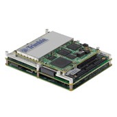
AP10

The Trimble AP10 GNSS-Inertial System is a cost-effective, self contained GNSS-Inertial OEM board set plus MEMS Inertial Measurement Unit for continuous positioning during short or partial GNSS signal outages.

  • Proven GNSS-Aided Inertial technology from Trimble Applanix
  • Centimeter level mobile positioning accuracy
  • Industry leading continuous positioning performance in GNSS denied environments
  • Full position and orientation solution for direct geo referencing of imaging systems
AP15

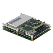
The Trimble AP15 GNSS-Inertial System is an embedded GNSS-Inertial OEM board set plus Inertial Measurement Unit (IMU) in a compact form factor, designed to give system integrators the ability to harness the best in GNSS multi-frequency positioning technology.


  • Proven GNSS-Aided Inertial technology from Trimble Applanix
  •  Centimeter level mobile positioning accuracy
  •  Industry leading continuous positioning performance in GNSS denied environments
  • Full position and orientation solution for direct geo referencing of remote sensing systems
  • Fully supported for all dynamic environments: terrestrial, airborne and marine
  • High-performance GNSS two antenna heading aiding from single receiver
  • Solid-state, purpose-built ruggedized MEMS IMU featuring Applanix SmartCal™ compensation technology

AP20

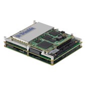
The Trimble AP20 GNSS-Inertial System is an embedded GNSS-Inertial OEM board, designed as an entry level solution for short or partial signal outages and close range georeferencing.


  • Proven GNSS-Aided Inertial technology from Trimble Applanix
  • Centimeter level mobile positioning accuracy
  •  Industry leading continuous positioning performance in GNSS denied environments
  • Full position and orientation solution for direct geo referencing of remote sensing systems
  • Fully supported for all dynamic environments: terrestrial, airborne and marine

AP40

The Trimble AP40 GNSS-Inertial System is an embedded GNSS-Inertial OEM board, designed as a mid-level solution for longer signal outages and mid distance georeferencing.


  • Proven GNSS-Aided Inertial technology from Trimble Applanix
  • Centimeter level mobile positioning accuracy
  • Industry leading continuous positioning performance in GNSS denied environments
  • Full position and orientation solution for direct geo referencing of remote sensing systems
  • Fully supported for all dynamic environments: terrestrial, airborne and marine

AP50

The Trimble AP50  is an embedded GNSS-Inertial OEM board, designed as a high performance solution for longest signal outages and highest accuracy georeferencing.
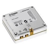
  • Proven GNSS-Aided Inertial technology from Trimble Applanix
  • Centimeter level mobile positioning accuracy
  • Industry leading continuous positioning performance in GNSS denied environments
  • Full position and orientation solution for direct geo referencing of remote sensing systems
  • Fully supported for all dynamic environments: terrestrial, airborne and marine

AP60

The Trimble AP60 is an embedded GNSS-Inertial OEM board, designed as a the highest performance solution for longest signal outages and highest accuracy georeferencing.

  • Proven GNSS-Aided Inertial technology from Trimble Applanix
  • Centimeter level mobile positioning accuracy
  • Industry leading continuous positioning performance in GNSS denied environments
  • Full position and orientation solution for direct geo referencing of remote sensing systems
  • Fully supported for all dynamic environments: terrestrial, airborne and marine

BD920-W3G

The Trimble BD920-W3G module has been designed for applications requiring centimeter accuracy in a compact package. By integrating wireless communications on the same module the task of receiving and transmitting data such as RTK corrections is greatly simplified. The BD920-W3G supports both L1 and L2 frequencies from the GPS and GLONASS constellations plus the E1 frequency from Galileo.

  • 220 Channels for multi-constellation GNSS support
  • Fully EMI shielded module
  • Compact design for mobile applications
  • Integrated Bluetooth™/Wi-Fi
  • Integrated 3.5G Cellular Modem
  • Flexible RS232, USB and Ethernet interfacing\
  • Centimeter level position accuracy

BD930-UHF

The Trimble BD930-UHF supports both triple frequency from the GPS and GLONASS constellations plus dual frequency from BeiDou and Galileo. This compact board integrates the latest generation of UHF receiver modems allowing the system to instantly receive corrections from a large installed base of GNSS reference stations.

  • 220 Channels for multi-constellation GNSS support
  • EMI shielded module
  • Compact design for mobile applications, Integrated 403-473 MHz UHF receiver
  • Flexible RS232, USB and Ethernet interfacing
  • Centimeter level position accuracy

Trimble BX982

The Trimble® BX982 GNSS receiver enclosure is a multi-channel, multi-frequency OEM GNSS receiver which allows OEM’s and System Integrators to rapidly integrate centimeter level positioning and precise heading into their application. The BX982 supports GPS L1/L2/L5, GLONASS L1/L2/L3, BeiDou B1, B2 and Galileo signals.

  • Easy to integrate rugged package
  • Two 220 channel Maxwell 6 chips for multi-constellation GNSS support
  • OmniSTAR VBS / XP / G2 / HP / RTX support
  • Dual antenna inputs for precise heading calculation
  • Centimeter level position accuracy
  • Convenience of Ethernet connectivity
  • Supports FDE and RAIM

Applanix POS AVX 210

GNSS-Inertial solution designed to reduce the cost and improve the efficiency of mapping with small and medium format cameras. The single rugged enclosure contains a precision GNSS receiver and inertial sensor components, logging capability, interface for mapping sensors and TrackAir Flight Management System. The POS AVX 210 is fully supported by POSPacMMS, powerful GNSS/Inertial processing software featuring the advanced Applanix SmartBaseTM and Applanix In-FusionTM technology for increased productivity.


  • High-performance Direct Georeferencing solution for improved efficiency and high accuracy of mapping with small and medium format digital cameras and low altitude LiDAR sensors
  • Reduce/eliminate GCP’s
  • Reduce Sidelap
  • Compact and rugged enclosure with survey-grade multi-frequency GNSS receiver and MEMS inertial components
  • Applanix IN-FusionTM GNSS-Inertial and SmartCalTM compensation technology for superior position and orientation performance
  • Compatible with TrackAir Flight Management System (NanoTrack)
  • Supported by POSPac MMS industry leading software for Direct Georeferencing of airborne mapping sensors
  • RTK position combined with high-accuracy orientation

Trimble® ABX-Two

The Trimble® ABX-Two is the successor to the Trimble ABX Series OEM sensors. The Trimble ABX-Two provides faster Dual Frequency based Heading acquisition and an improved positioning engine with additional GNSS signals. In addition, the ABX-Two can support two modules that can be used for Precise Platform Position (P3) using data from three antennas for full GNSS attitude.

Key Features:

  • Dual Core Engine with Z-Blade Technology
  • HIGH PERFORMANCE RTK receiver
  • 5 Dual-Band GNSS
  • Precise 3D ATTITUDE
  • Precise Point Positioning using Trimble® RTX
  • Compact, Lightweight Enclosure

Bullet GG

Trimble’s Bullet™ GG Antenna provides a perfect solution for manufacturers who need a fixed-sight, rooftop GNSS antenna. It is housed in leak tested packaging designed to withstand continuous exposure to shock, excessive vibration, extreme temperatures, water and sunlight. For added reliability, the antenna cable can be threaded through a pole mount to keep it safe from environmental damage.

The Bullet GG Antenna includes advanced filtering technology for reliable performance in hostile RF jamming environments. This antenna is also a high-quality solution for adding GNSS data to marine navigation systems.

Key Features:

  • Multi-Constellation (GPS & GLONASS)Weatherproof housing
  • Filtering for harsh RF jamming environments
  • Proven extra rugged, reliable
  • Available in 3.3v (TNC) or 5v (TNC or F)
  • RoHS II -Compliant (Pb-free)

AV33 GNSS Antenna

The Trimble AV33 GNSS Antenna has been designed to support high accuracy aerial, land and marine applications in one small, compact design. The rugged 4-hole bulkhead mounting allows the antenna to be used in the most rugged of environments.

  • Support for GPS L1, GLONASS L1, Galileo
  • E1 and Compass B1
  • Low-profile Fuselage/Bulkhead Mounting
  • Sub-centimeter phase center repeatability

Small rugged package ideal for vehicle or man portable

AV34 GNSS Antenna

The Trimble AV34 GNSS Antenna been designed to support high accuracy aerial, land and marine applications in one small, compact design. The Trimble AV34 GNSS antenna offers support for both GPS and GLONASS L1/L2 signals.

  • Support for GPS L1, GLONASS L1, GPS_L2, and GLONASS L2
  • Low-profile Fuselage/Bulkhead Mounting
  • Sub-centimeter phase center Repeatability
  • Small rugged package ideal for vehicle or man portable applications

AV37 GNSS Antenna

The Trimble AV37 GNSS antenna conforms to strict standards of consistency and performance to deliver the best possible tracking to support centimeter level accuracy on aerial, land and marine applications. Unique antenna designs provide the flexibility to reach a wide range of operational goals.

  • Full support for L1/L2 GPS + GLONASS and L-Band signals
  • Low-profile Fuselage Mounting
  • Sub-centimeter phase center repeatability
  • Fully certified for airborne installations

AV59 GNSS Antenna

The Trimble AV59 Aviation GNSS Antenna has been designed to support centimeter level accuracy on aerial, land and marine applications. The rugged 8-hole bulkhead mounting allows the antenna to be used in the most rugged of environments.

  • Comprehensive GNSS support, including GPS Modernization signals,
  • Rugged Package ideal for vehicle applications
  • Bulkhead Mounting GLONASS, and Galileo
  • Sub-centimeter phase center repeatability
  • The Trimble AV59 antenna is also available in dark green.

AG25

The Trimble® AG25 Antenna is a general purpose GNSS rover antenna ideal for dynamic applications where position and heading are required. The GA810 offers excellent OmniSTAR (L-Band), GPS and GLONASS signal reception, making it ideal for use with the OmniSTAR G2 service as well as GPS/GLONASS positioning and heading applications.

  • Optimized for dynamic applications that require both position and heading
  • Recommended for best OmniSTAR reception
  • Comprehensive GNSS support, including GPS Modernized signals, GLONASS, and Galileo
  • Robust low-elevation satellite tracking
  • Magnetic mounting system

GA810

The Trimble® GA810 Antenna is a general purpose GNSS rover antenna ideal for dynamic applications where position and heading are required. The GA810 offers excellent OmniSTAR (L-Band), GPS and GLONASS signal reception, making it ideal for use with the OmniSTAR G2 service as well as GPS/GLONASS positioning and heading applications.

  • Optimized for dynamic applications that require both position and heading
  • Recommended for best OmniSTAR reception
  • Comprehensive GNSS support, including GPS Modernized signals,
  • Robust low-elevation satellite tracking GLONASS, and Galileo

LV59 GNSS Antenna

The Trimble LV59 Aviation GNSS Antenna has been designed to support centimeter level accuracy on land and marine applications. The rugged 5/8″ x 11 female threaded mount and all aluminum base allows the antenna to be used in the most rugged of environments.

  • Comprehensive GNSS support, including GPS Modernization signals, GLONASS, and Galileo
  • Rugged Package ideal for vehicle applications
  • 5/8″ x 11 Mounting
  • Sub-centimeter phase center repeatability

Zephyr Geodetic Antennas

The top of the range Trimble® Zephyr™ external GNSS antenna contains advanced technology for multipath reduction, outstanding low elevation satellite tracking, and sub- millimeter phase center stability. The Trimble Zephyr 2, Zephyr 2 Rugged, and Zephyr 2 Geodetic antennas offer full support for current and near-future GNSS signals in combination with the rugged durability of each antenna, means the investment in a Trimble Zephyr series antenna will last for many years.

Comprehensive GNSS support, including:

  • GPS Modernization signals, GLONASS, BeiDou and Galileo
  • Robust low-elevation satellite tracking
  • Minimized multipath
  • Sub-millimeter phase center repeatability
  • Ideal for fixed reference stations and GNSS infrastructure networks

Zephyr Model 2 Antenna

The range Trimble Zephyr™ external GNSS antenna contains advanced technology for multipath reduction, outstanding low elevation satellite tracking, and sub-millimeter phase center stability. The Trimble Zephyr 2, Zephyr 2 Rugged, and Zephyr 2 Geodetic antennas offer full support for current and near-future GNSS signals in combination with the rugged durability of each antenna.

  • Comprehensive GNSS support, including GPS Modernization signals, GLONASS, BeiDou and Galileo
  • Robust low-elevation satellite tracking
  • Minimized multipath
  • Sub-millimeter phase center repeatability
  • Ideal for fixed reference stations and GNSS infrastructure networks GLONASS, BeiDou and Galileo