
LiDAR Mobile Mapping Systems

Mapping & Rugged Positioning, Navigation and Timing Solutions.

A broad array of precise Positioning, Navigation and Timing (PNT) solutions designed to address a wide range of requirements for Air, Sea and Land, including high speed pointing/attitude and relative position/angle applications.

Robustly engineered, self-contained systems, that are simple to operate and enable a rapid deployment in the field. The PNT products are designed to provide critical PNT information under demanding conditions.

Compatible Software products- including software toolbox, visualization and analysis tools specially developed to help you handle your resulting PNT data easily and quickly.

Applications are as diverse as the platforms using this information ranging from PNT for stationary or slowly moving platforms such as Aerostats to PNT for high-dynamic aircraft and everything in between.

Our leading mobile mapping solutions include the Aevex Geodetics Geo-MMS , Point & Pixel, the Routescene LidarPod® and the SatLab Apus-MX, Cygnus 3 SLAM , Cygnus Lite & Sat-LiDAR Point Cloud Data Processing Software.

GEODETICS IS NOW a part of AEVEX AEROSPACE.

 

Quotation Request

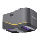
SatLab Apus-MX UAV LiDAR System

This ultra-portable system seamlessly integrates a powerful long-range laser scanner, an advanced IMU, and an industrial-grade RGB orthographic camera, delivering high precision and efficiency for complex airborne survey missions.


Its versatile applications span across large-area terrain mapping, road and power line patrol, mining and quarrying, forestry canopy analysis, and disaster risk mitigation.

As a robust and intelligent airborne solution, Apus-MX excels in flying at higher altitudes over steep, hazardous terrain while penetrating dense vegetation to capture clear ground surfaces.

Key Features:

  • Data Rate: High-frequency pulse repetition with up to 8 returns per pulse
  • Effective Pixel: 45 Mega Pixel high-resolution RGB camera
  • LiDAR Measuring Range: Max 1200 m (ideal for high-altitude UAV flight)
  • Field of View (FOV): 80°
  • Scanning Speed: 260 scans per second
  • Dense Vegetation Penetration: Up to 8 echoes for DEM/DSM generation
  • UAV Compatibility: Rapid integration with professional multirotor platforms
  • Ultra-Portable: 1.55 kg total system weight
  • Workflow: Automated point cloud colorization and strip adjustment via Sat-LiDAR software

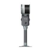
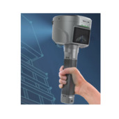
SatLab Cygnus 3 SLAM Scanner

This portable engineering-grade handheld system combines high-precision 3D LiDAR scanning, real-time vision algorithms, and continuous spatial localization to generate accurate point clouds without relying on GNSS signals.


Its versatile applications span across underground mine surveys, building interior/BIM mapping, asset inventory, tunnel inspections, and forestry management.

As a flexible handheld solution, Cygnus 3 excels in GNSS-denied environments, enabling rapid walking scans in complex, enclosed, or highly detailed structures.

Key Features:

  • Data Rate: 200,000 points/sec
  • Camera System: Integrated panoramic/panoptic vision sensor for real-time RGB colorization
  • LiDAR Measuring Range: Up to 70 m
  • Field of View (FOV): 360° wide spatial coverage
  • SLAM Precision: Centimeter-level relative accuracy for indoor and underground mapping
  • Operating Mode: Mobile handheld / backpack / vehicle-mountable versatility
  • Environment Rating: IP54 durable enclosure for challenging job sites

Real-time Processing: Live 3D visualization and cloud rendering on companion app

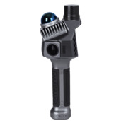
SatLab Cygnus Lite Handheld SLAM Scanner

This ultra-lightweight handheld SLAM scanner redefines mobile data collection with an innovative tilted sensor design, dual wide-angle RGB cameras, and an integrated RTK positioning module.


Its versatile applications span across Scan-to-BIM, real-time volume measurement, facade scanning, indoor floor plan generation, and urban feature inventory.

As a mobile and ergonomic scanner, Cygnus Lite excels in fast field operation, reducing missing data gaps in tight corners and structural blind spots.

Key Features:

  • Data Rate: 200,000 points/sec at 10 Hz scanning frequency
  • Effective Camera: Dual 12 MP HD wide-angle cameras (360° x 270° FOV)
  • LiDAR Measuring Range: 40 m @ 10% reflectivity / 70 m @ 80% reflectivity
  • Field of View (FOV): 360° × 59° LiDAR FOV with a 20° tilted scanning mechanism
  • Positioning Tech: LiDAR SLAM fused with integrated multi-constellation RTK GNSS
  • Lightweight: 1.0 kg (with battery installed)
  • Power System: Swappable handle batteries providing up to 90 min continuous operation each
  • Storage: 256 GB expandable TF card storage

SatLab SL9 SLAM RTK Solution

This hybrid measurement system fuses high-precision GNSS RTK positioning with real-time SLAM laser scanning technology, allowing surveyors to break free from traditional line-of-sight satellite constraints.


Its versatile applications span across urban canyon surveying, dense tree canopy boundary surveys, utility mapping, bridge underpass scans, and steep slope measuring.

As a ground surveying tool, SL9 excels in non-stop data acquisition by seamlessly transitioning from RTK fix satellite mode to SLAM non-GNSS mode.

Key Features:

  • Hybrid Positioning: Multi-constellation, multi-frequency GNSS RTK fused with optical-assisted LiDAR SLAM
  • LiDAR Integration: Built-in low-power LiDAR engine for touch-free indirect offset measurements
  • RTK Accuracy: Horizontal: 8 mm + 1 ppm; Vertical: 15 mm + 1 ppm
  • Non-GNSS Measurement: Measures points directly under covered, shaded, or satellite-blocked areas
  • Tilt Compensation: High-precision IMU tilt survey up to 60° without magnetic calibration
  • Connectivity: Built-in 4G network, UHF radio, Wi-Fi, and Bluetooth modules
  • Durability: IP68 dust/water protection with rugged drop-resistant casing

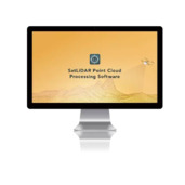
Sat-LiDAR Point Cloud Data Processing Software

This comprehensive, user-friendly post-processing desktop suite provides a unified workflow for managing and processing point cloud data from airborne UAV systems and handheld SLAM devices.


It converts raw flight trajectories and laser scans into high-precision, georeferenced 3D point clouds and orthophotos through automated processing pipelines.

Its versatile applications span across topographical terrain modelling, AEC floor plan extraction, stock volume calculations, forest inventory analysis, and infrastructure inspection.

As a powerful processing hub, Sat-LiDAR excels in handling complex datasets, automating strip alignment, point cloud colorization, and terrain extraction with minimal manual intervention.

Key Features:

  • Modular Engine: Dedicated Airborne (Apus Series) and SLAM (Cygnus / SL9) processing modules
  • One-Click Wizard: Automated trajectory solution, strip alignment, point cloud smoothing, and RGB colorization
  • Data Fusion: Integrates RTK/PPK GNSS positioning, control points (GCPs), and SLAM data for enhanced spatial precision
  • Terrain Processing: Automatic ground filtering, Digital Elevation Model (DEM) generation, and contour line production
  • AEC & BIM Tools: Point cloud slicing/unfolding, profile section extraction, and CAD-ready geometry export
  • Volumetric Analysis: High-accuracy stock pile, cut/fill, and multi-volume calculations with automated reporting
  • Orthophoto Output: Generates high-resolution Digital Orthophoto Maps (DOM) directly from aerial imagery
  • Geodetic Engine: Full global coordinate system support with geoid model transformations
GEO MMS

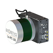
Geo – MMS

Geo-MMS is a fully integrated LiDAR mapping payload for integration with small unmanned vehicles. The Geo-MMS includes an inertial navigation system coupled with a LiDAR sensor. Raw data from the integrated GPS, IMU and LiDAR sensors are recorded on the internal data recording device and can be post-processed using Geodetics’ LiDAR tool software package to directly geo-reference the LiDAR point clouds with LAS format output. Geo-MMS is available with a wide range of sensors.

Key Features:

  • Flexible mounting for different platforms including UAV, UAS, ground vehicles and robots
  • Minimized sensor size and weight to meet payload restrictions (5 pounds minimum payload)
  • Available with a many IMU’s to support a wide range of application requirement
  • Centimeter-level position accuracy (dual-frequency RTK configuration)
  • On-board data logging of all raw and navigation solution data
  • User interface to fully control individual and collective GPS, IMU, Laser setting
  • Full post-processing support with GPS/IMU Geo-PostProcessing
  • LAS file output
Point&Pixel

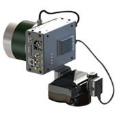
Point&Pixel™ – Combined LiDAR and Photogrammetry

Point&Pixel combines the best of Geodetics’ Geo-Photomap and Geo-MMS LiDAR products by integrating LiDAR point clouds with Photogrammetry and delivering stunning colorized LiDAR point clouds.

Key Features

  • Combines LiDAR and Photogrammetry point clouds
  • Enhances visualization
  • Enables LiDAR point cloud colorization
  • Enhances DTM/DEM extraction
  • Facilitates LiDAR point cloud classification
  • Orthophoto generation in areas Photogrammetry fails (i.e., glaciers, tree canopy, mine site conveyors, etc.)
  • Change detection (2D, 3D, 4D)

LidarPod

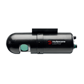
The Routescene LidarPod® is cutting edge 3D mapping technology which is transforming the approach to surveys. Your self contained LidarPod® contains an HDL32 LiDAR scanner, a survey grade GPS/INS, data storage and radio telemetry.

Lightweight and compact, the LidarPod can be fitted onto any mobile platform you require. It has been designed specifically for use on UAVs and can also be used on vehicles.

Key Features:

  • saves time, generating more detailed and faster results
  • avoids exposure of personnel to awkward, dangerous and hostile environments
  • reduces time in the field and collects significantly more data compared to conventional survey techniques
  • collates accurate, detailed measurements from the air, which are more difficult to achieve with conventional surveying
  • achieves quicker results by collecting all the data needed in a single pass – much quicker than traditional methods
  • the higher density of data collected provides a much more detailed 3D view
  • collects data from different angles to minimize shadows
  • enables increased visibility in difficult to penetrate terrains such as forests
  • it is portable, lightweight and compact, suitable as flight hand luggage
  • independently CE and FCC certified to ensure compliance with electrical and radio transmission standards