IMU & NAV

Inertial Measurement Sensors are used in a wide variety of applications. Those include Inertial Measurement Units (IMU) and Navigation Systems (NAV).

We offer a broad range of high quality and reliable IMU and Navigation systems of our leading global partners.

Aevex Geodetics is an expert in Navigation systems and advanced sensing systems. Aevex Geodetics precise Positioning, Navigation and Timing (PNT) solutions are designed to address a wide range of requirements for Air, Sea and Land, including high speed pointing/attitude and relative position/angle applications.

Geodetics is now a part of Aevex Aerospace.


Quotation Request

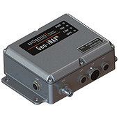
Geodetics Geo – iNAV

The Geo-iNAV® is a high-performance, rugged GPS-aided inertial navigation system. The Geo-iNAV tightly couples an RTK-enabled dual-frequency GPS sensor with a wide range of IMU’s including fiber-optic gyro and ring- laser gyro IMU’s for the highest levels of accuracy. The Geo-iNAV provides on-board data recording and hosting of user applications via the SDK. Geo-iNAV is designed to meet a wide range of Air, Land and Sea requirements.

Key Features:

  • Simple integration
  • RTK enabled dual-frequency GPS
  • Wide range of supported IMU’s
  • Tight-coupling with Geodetics’ Extended Kalman Filter
  • On-board data recording
  • Post-processing support with RTD-Post
  • In-motion dynamic alignment
  • Wander Azimuth frame
  • RS-232, RS422 and Ethernet (TCP/UDP) interfaces
  • Includes GPS antenna and cables

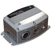
Geodetics Geo – iNAV 1000

The Geo-iNAV® 1000 is a low-cost, rugged GPS-aided inertial navigation system. The Geo-iNAV 1000 tightly couples a single-frequency GPS sensor with a high-stability Quartz MEMS IMU to provide a high-performance navigation solution in challenging environments.

Key Features:

  • Simple integration
  • Single-frequency GPS
  • Internal high-accuracy Quartz MEMS IMU
  • Tight-coupling with Geodetics’ Extended Kalman Filter
  • In-motion dynamic alignment
  • Wander Azimuth frame
  • RS-232, RS422 and Ethernet (TCP/UDP) interfaces
  • ITAR Free
  • Includes GPS antenna and cables

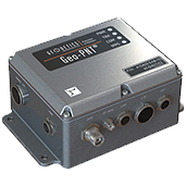
Geodetics Geo – PNT

The Geo-PNT® is an innovative and efficient solution for applications that need precise navigation data, as well as accurate time reference.  The Geo-PNT combines a high performance, versatile, GPS master clock with an accurate inertial navigation system that delivers position, navigation and timing (PNT) under all circumstances, including temporary loss of GPS, typical of dynamic platforms. The Geo-PNT minimizes size, weight and power (SWaP) due to the integration of positioning and timing that are typically achieved by two independent subsystems.

Key Features:

  • GPS-aided inertial navigation and timing
  • High performance internal timebase
  • Software configurable timing interfaces
  • NTP network synchronization protocol
  • Precise 1 PPS, 10 MHz and other timing signals
  • Simple integration
  • Ruggedized form factor (MIL-STD-810G)
  • RTK enabled dual-frequency GPS
  • Wide range of supported IMU’s
  • Tight-coupling with Geodetics’ Extended Kalman Filter
  • In-motion dynamic alignment
  • Wander Azimuth frame
  • RS-232 and Ethernet (TCP/UDP) RS-422 optional
  • Includes GPS antenna and cables

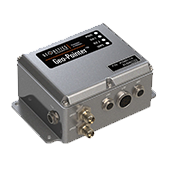
Geodetics Geo – Pointer

The Geo-Pointer is a rugged, high-accuracy GPS-based heading system for use on applications where an inertial heading solution is difficult to obtain such as on stationary or slowly moving platforms. The system utilizes highly accurate relative positions between two GPS antennas mounted on a platform to compute precise heading information.

Key Features:

  • Determines attitude of any rigid structure to which it is attached
  • Completely autonomous – no external reference is needed for attitude
  • Simple integration
  • Calibration mode automatically computes antenna separation
  • Not sensitive to magnetic field
  • Complements inertial guidance systems in that there are no long term drifts
  • Includes GPS antennas and cables

Geodetics Geo – RelNAV

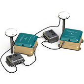
Geo-RelNAV® is a unique navigation system that provides relative navigation information between moving platforms. Information computed by the system includes values such as relative velocity (closure rate) and relative orientation.  This information can be used for applications including autonomous aerial refueling, autonomous shipboard landing, vehicle platooning and UAV swarming.

The system natively provides solutions in the correct, non-inertial reference frame. Solutions are available via serial and/or Ethernet (both TCP and UDP) providing convenient input to external systems as well as the tools for analysis engineers to monitor the data in real-time using standard monitoring and recording tools. Geo-RelNAV® provides R-TSPI in different frames, including body-frame, local navigation frame (wander-azimuth) and earth-fixed frame, as well as transferring the solution to arbitrary points of interest on the platform.

Key Features:

  • Each Geo-RelNAV® system includes 2 subsystems, primary and secondary.
  • Size/ Weight/Power – 33.8 in3 (3.95×3.05×2.06) / 14.4 oz. / 10 – 30 VDC @ 2 Amps min. (each subsystem, not including external IMU).
  • Temperature Range – Specified: -20°C to +60°C | Operating: -40°C to +70°C.
  • Interfaces – External power connector, TNC GPS antenna connector, 1 Ethernet data port, 3 RS-232 serial ports, 1PPS output, 4 status LEDs.
  • Real-Time Data Output – Navigation solutions at IMU rate (depending on data link throughput) available via Ethernet, RS-232.
  • Data Recording/Logging – Navigation solutions, raw sensor data, diagnostics.
  • Web User Interface (status, configuration, log, SW update).