Differential Correction Services

The need for reliable and accurate positioning is not limited to surveying. Today, a variety of industries including electric and gas, utilities, water and wastewater services, and land management projects require mapping products that provide decimeter or better accuracy.

Trimble offers a range of correction services for any accuracy requirement. High performance reference station networks provide confidence that collected data meets the required accuracy levels

OmniSTAR , a Trimble company, is one of the world’s leading suppliers of satellite-based augmentation services for onshore and offshore GNSS applications. OmniSTAR offers a large number of services like VBS, HP/ XP , RTX , AirStar.

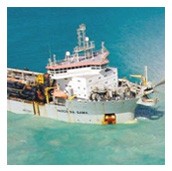
MarineStar correction services are suitable for VBS ,HP & RTK cm positioning accuracy for offshore applications and cover all the seas and oceans. All services are available worldwide and include corrections for GPS & Glonass.

Our broad range of products includes Trimble Centerpoint RTX, Trimble FieldPoint RTX, Omnistar HP, Omnistar XP, Omnistar VBS, Trimble Rangepoint RTX, Trimble Viewpoint RTX, Omnistar G2 (GPS+Glonass), Trimble VRS Now, Omnistar AirStar and the Marinestar system.


Quotation Request

Trimble FieldPoint RTX

Trimble FieldPoint RTX provides decimeter accuracy around the globe.

It’s perfect for mapping large asset locations, determining large boundary areas, and any job requiring high accuracy.

Ideal for applications that require high-accuracy of less than 10 centimeters, helping you get your job done fast with reliable positions.

Trimble CenterPoint RTX

Trimble® CenterPoint™ RTX™ delivers GNSS (GPS, GLONASS, QZSS, BeiDou) enabled, repeatable 1.5-inch (3.8 cm) corrections to your receiver anywhere in the world. Available via satellite or cellular delivery, CenterPoint RTX Standard converges to the full accuracy in 30 minutes or less. Positions may also be used much sooner at a lower accuracy level—the user decides. CenterPoint RTX corrections can be delivered directly to the built-in receiver of your Trimble BX982™ receiver, BX935-INS® ,Geo 7X hand held, CFX-750™ display, or AG-372 GNSS receiver.

Trimble® CenterPoint™ RTX™ Standard delivered via satellite is the most accurate satellite- delivered correction service available. It doesn’t require an RTK base station or cellular service and is available throughout North America, South America, most of Europe, Russia and the Commonwealth of Independent States (CIS), Africa, Asia and Australasia.

OmniSTAR HP – 10cm High Performance

OmniSTAR HP service is the most accurate solution available in the OmniSTAR portfolio of correction solutions. It is a L1/L2 solution requiring a dual frequency receiver. OmniSTAR HP corrections are modeled on a worldwide network of reference sites using carrier phase measurement to maximize accuracy. The expected 2-sigma (95%) accuracy of OmniSTAR HP is 10cm. It is particularly useful for Agricultural Machine guidance and many surveying tasks. It operates in real time and without the need for local Base Stations or telemetry links. OmniSTAR HP is a true advance in the use of GPS for on-the-go precise positioning.

Delivery: Via Satellite

Available worldwide

Provides better than 10 cm horizontal accuracy

Converges to full accuracy in less than 30 minutes

GPS, GLONASS, BeiDou, and QZSS enabled

No base station required

OmniSTAR XP – 15cm Worldwide Service

OmniSTAR XP is a worldwide dual frequency high accuracy solution. It is a L1/L2 solution requiring a dual frequency receiver. Orbit and Clock correction data is used together with atmospheric corrections derived from the dual frequency data. By utilizing carrier phase measurement, very high accuracy can be achieved. OmniSTAR XP service provides short term accuracy of 1-2 inches and long term repeatability of better than 15 centimeters, 95%. It is especially suited for Agricultural automatic steering systems. While it is slightly less accurate than OmniSTAR HP, it is available worldwide and its accuracy is a significant improvement over regional Differential Systems such as WAAS.

Delivery: Via Satellite

Available worldwide

Provides better than 15 cm horizontal accuracy

Converges to full accuracy in less than 30 minutes

GPS, GLONASS, BeiDou, and QZSS enabled

No base station required

OmniSTAR VBS – Global Reliable Sub-Meter Accuracy

OmniSTAR VBS is the foundational “sub-meter” level of service. It is an L1 only, code phase pseudo-range solution. Pseudo-range correction data from OmniSTAR’s regional reference sites is broadcast via satellite link to the user receiver. These data are used, together with atmospheric modeling and knowledge of the receiver’s location, to generate an internal RTCM SC104 correction specific to that location. This correction is then applied to the real time solution. A typical 24-hour sample of OmniSTAR VBS will show a 2-sigma (95%) of significantly less than 1 meter horizontal position error and the 3-sigma (99%) horizontal error will be close to 1 meter.

Delivery: Via Satellite

Available worldwide

Provides better than 1m horizontal accuracy

Converges to full accuracy in less than 5 minutes

GPS, GLONASS, BeiDou, and QZSS enabled

No base station required

Ideal for general utility infrastructure, environmental management, road works and

park management.

Trimble RangePoint RTX

Trimble RangePoint™ RTX is a GPS and GLONASS enabled correction service built on Trimble’s exclusive RTX technology. This affordable, entry-level correction service, delivers up to 15 cm (6 inch) pass-to-pass and 50 cm (20 inch) repeatable horizontal accuracies, making it ideal for broad acre applications. Because it is delivered via satellite broadcast, there is no need to fear losing radio signal reception: RangePoint RTX does not require the use of traditional base stations and additional communication devices. The service is delivered directly to the built-in receiver of your Trimble BX982 receiver, BX935-INS,Geo 7X handheld, CFX-750™ display, or AG-372 GNSS receiver.

Trimble RangePoint™ RTX corrections converge to full accuracy in less than 5 minutes, and often in less than 1 minute.

Available nearly worldwide

Provides 15 cm (6 inch) pass to pass accuracy and 50cm (20 inch) repeatable accuracy

Converges to full accuracy in less than 5 minutes, some users will experience convergence in less than 1 minute

GPS, GLONASS, BeiDou, and QZSS enabled

More uptime – Continue working through correction signal interruptions for up to 2 minutes

No base station required

GPS, GLONASS, BeiDou, and QZSS included with active RangePoint™ RTX subscriptions

A number of software applications on the Geo7X support RangePoint RTX, such as TerraSync™, TerraFlex™, and Trimble Positions™

Trimble ViewPoint RTX

Trimble ViewPoint RTX™ is a GPS, GLONASS, BeiDou and QZSS correction service built on Trimble’s exclusive RTX technology. This affordable, entry-level correction service, delivers better than 1m horizontal accuracy, making it ideal for utility infrastructure, environmental management, road works and park management.

Delivery: Via Cellular and via Satellite

Available worldwide

Provides better than 1m horizontal accuracy

Converges to full accuracy in less than 5 minutes

No base station required

Ideal for general utility infrastructure, environmental management, road works and park management.

ViewPoint RTX is compatible with the Trimble Geo 7X, the new Trimble R1 GNSS receiver, Trimble PG200 and the new Trimble Leap

ViewPoint RTX on the Trimble Leap is ideal for collecting markers, tracks, and photos in the field.

A number of software applications support ViewPoint RTX, including Trimble TerraSync™, Trimble TerraFlex™, Trimble Positions™ and Terrain Navigator Pro

Omnistar G2 (GPS + GLONASS)

OmniSTAR G2 represents the most recent advancement in OmniSTAR subscription service offerings. It is a worldwide dual frequency high-accuracy solution which uses Orbit and Clock correction data. The addition of GLONASS to the solution significantly increases the number of satellites available. Provides short-term accuracy of 1-2 inches and long term repeatability of better than 10 centimeters, 95%. Especially suited for operations in areas where trees or buildings may block the view of the sky and in areas affected by scintillation during times of high sunspot activity.

Delivery: Via Satellite

Available worldwide

Provides better than 10 cm horizontal accuracy

Converges to full accuracy in less than 30 minutes

GPS, GLONASS, BeiDou, and QZSS enabled

No base station required

Trimble VRS Now

VRS Now provides instant access to real-time kinematic (RTK) corrections utilizing a network of permanent (fixed) continuously operating reference stations. Availability: Unites States, Europe and Australia High Accuracy: Provides < 2 cm (1″) accuracy Ideal for a variety of industries needing high precision including survey and construction, mapping and GIS, cadastral, utilities, transportation and areas having good cellular coverage Instant Initialization: Start working immediately under optimal conditions Multi-constellation support: GPS, GLONASS and QZSS enabled

More uptime: Built-in redundancy to ensure connectivity, consistency and quality

No base station required: No need to worry about losing radio signal reception since a base station is not needed for Trimble VRS Now based correction services

Omnistar AirStar

OmniSTAR AirStar is satellite-based augmentation service for onshore and offshore Airborne GNSS applications. OmniSTAR AirStar currently offers three services: VBS, HP and XP. OmniSTAR VBS is the code-based service, suitable for sub-meter positioning accuracy. The HP and XP services provide sub-decimeter accuracy. The services are suitable for dynamic application above 50 m/s .

MarineStar

The Marinestar system ( a Fugro Company) is a global real-time GNSS broadcast system delivering corrections for offshore services from an array of base stations positioned throughout the whole world. The need for reliable and accurate positioning for offshore Hydrographic , Fishery, Dredging surveying requires a reliable mapping products that provide decimeter or better accuracy. MarineStar offers a range of correction services for any accuracy requirement. High performance reference station networks provide confidence that collected data meets the required accuracy levels.

MarineStar VBS is suitable for sub-meter positioning accuracy. MarineStar HP/XP is suitable for sub-decimeter positioning accuracy. All Marine Star, Services are available for GPS & Glonass ,worldwide Offshore applications and covers all seas and oceans.